 Ulaanbaatar
Braille maps created for visually impaired students
Society
Ulaanbaatar /MONTSAME/ The Ministry of Construction and Urban Development in cooperation with the Authority for Land Administration, Geodesy and Cartography handed over four types of Braille maps to the Special Needs School No.116.
The first Braille maps for visually impaired persons were issued and introduced to the geography curriculum of secondary schools in 2018. It includes the world map, map of Mongolia, overview map of the School No. 116 and the schoolyard map.
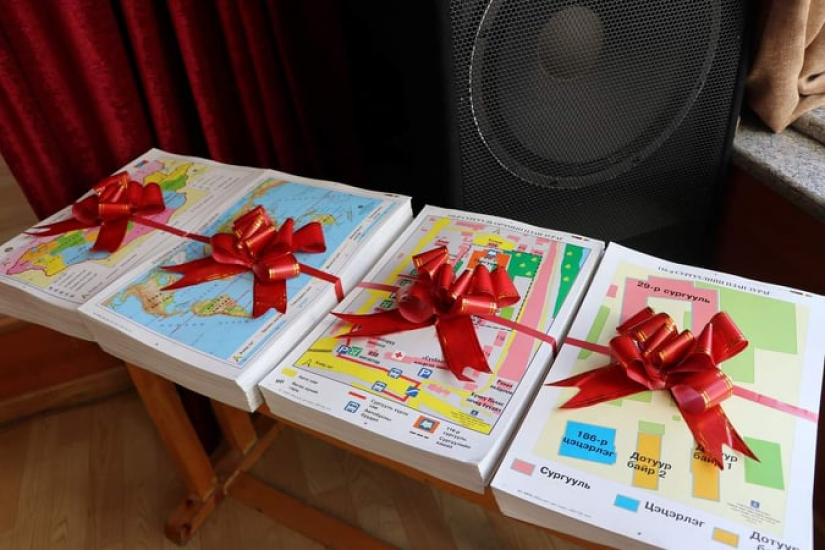
With these maps the students will be able to improve their geographical knowledge by learning the locations, shapes and territories of the provinces, other countries, seas and oceans. It also gives the students opportunity to get to the school from the bus station and wander around the schoolyard by themselves.
In the future, it is planned to release the ‘Atlas of Mongolia for visually impaired persons’.
Related news